The Measure tool allows users to measure area, distance, and location (i.e., coordinates) on the map.
Click the Measure tool on the FRIS toolbar to open the Measure Tools form.
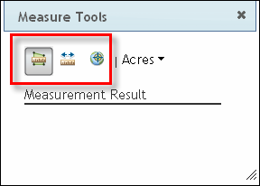
From the Measure Tools form, you can access the Area, Distance, and Location tools.
To measure the area of a location, perform the following steps:
1. Click the Measure tool on the FRIS toolbar to open the Measure Tools form.
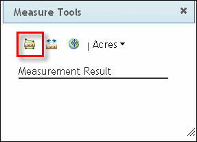
2. Click the Area tool on the Measure Tools form.
3. To measure the area of a location, you will draw a polygon around the perimeter of the location, and FRIS will calculate the area for you. First, click anywhere on the perimeter of the area you wish to measure. Then, move the pointer to the desired ending point for the first side of the polygon and click the mouse button once to finish drawing the first line segment. You will see the line segment being drawn as you move the mouse, and the line's length and position automatically adjust according to where you move the pointer.
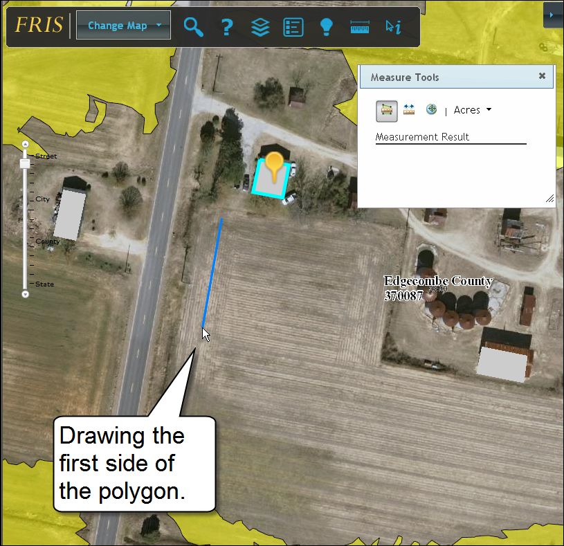
4. Move the pointer to the desired ending point for the second side of the polygon and click the mouse button once to finish drawing the second line segment. Repeat this process until you have finished drawing the polygon around the perimeter of the area you wish to measure.
Note: To measure area, the Area tool requires a closed polygon. Therefore, FRIS automatically closes the polygon for you as you add line segments.

5. When finished drawing the polygon, double-click the mouse button. The area measurement is displayed in the Measure Tools form.
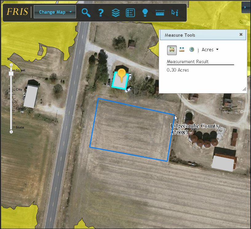
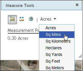
6. The default unit of measure is acres. If desired, click the down arrow next to Acres and select an alternative unit of measure from the list.
To measure distance, perform the following steps:
1. Click the Measure tool on the FRIS toolbar to open the Measure Tools form.
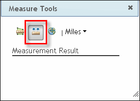
2. Click the Distance tool on the Measure Tools form.
3. To measure distance, you will draw two or more line segments between points on the map, and FRIS will calculate the distance for you. First, click on the desired starting location on the map. Then, move the pointer to the desired ending point for the line segment. If you do not wish to add any additional line segments, double-click the mouse button to finish drawing the line.

However, if you wish to draw multiple, connected line segments (sometimes called a polyline), click the mouse button once and continue drawing line segments using the pointer. A new segment will be added each time the mouse button is clicked. In the example below, the line consists of two line segments.
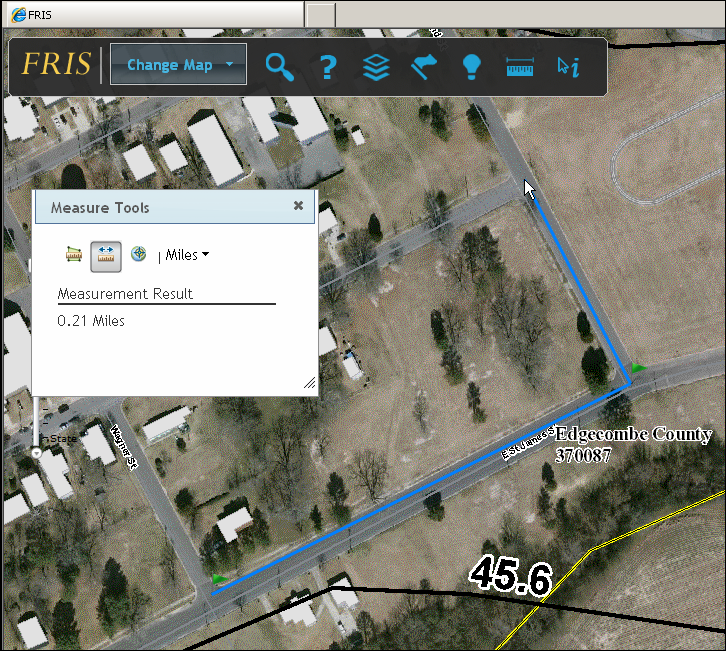
4. When finished adding line segments, double-click the mouse button. The distance measurement is displayed in the Measure Tools form.
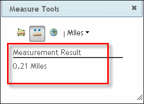
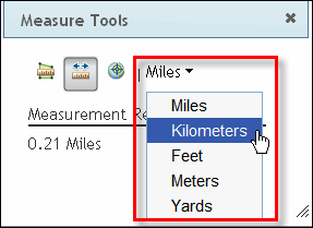
5. The default unit of measure is miles. If desired, click the down arrow next to Miles and select an alternative unit of measure from the list.
To find the longitudinal and latitudinal coordinates for a location, perform the following steps:
1. Click the Measure tool on the FRIS toolbar to open the Measure Tools form.
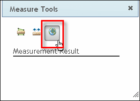
2. Click the Location tool on the Measure Tools form.
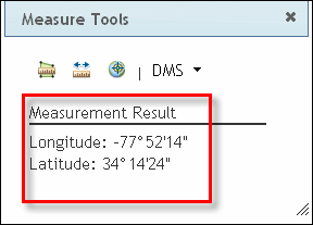
3. Click the location on the map for which you wish to know the longitude and latitude. FRIS displays a flag icon on the selected location, and the Measure Tools form displays the measurement result.
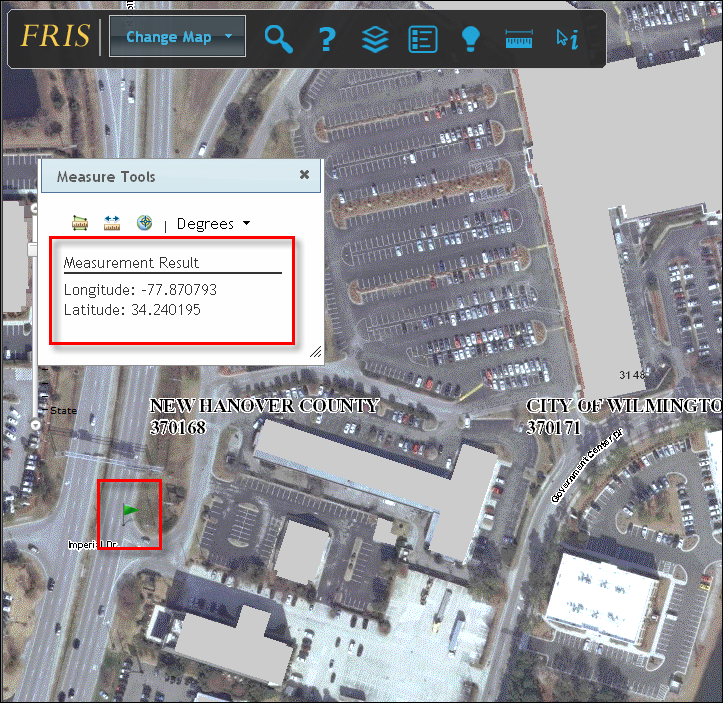
4. By default, the longitude and latitude are displayed in decimal degrees. To display the longitude and latitude in degrees, minutes, and seconds, click the down arrow next to Degrees and select DMS.
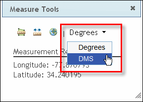
The Measure Tools form updates and displays the results in degrees, minutes, and seconds.